Business Details
32 Years
experience
Professional Surveying Services in Chesapeake, VA
Alphatec Surveyors has been a trusted provider of professional surveying services since 1994, serving Southeast Virginia and Northeast North Carolina. Our team combines decades of industry experience with cutting-edge technology, including GPS and unmanned aerial systems, to deliver precise 3D modeling and aerial imagery. We specialize in addressing complex surveying challenges for real estate developers, mortgage title entities, engineers, and homeowners. Our commitment to innovation ensures clients receive accurate data efficiently, enhancing productivity and project outcomes.With a focus on client satisfaction, we maintain rigorous quality standards across all survey types, from topographic mapping to machine control solutions. Our expertise in navigating regional topographic variations ensures compliance with mortgage lending requirements and construction specifications. As a locally rooted company, we prioritize personalized service while maintaining national technical excellence. Our affiliations and use of advanced methodologies underscore our position as a regional leader in surveying technology and methodology.
Services
Surveying/Mapping
Mortgage Related Surveys
ALTA/ACMS Surveys
FEMA Flood Certificates
In-Shore Hydrographic Surveys
CBPA Plan Surveys
As-Built Surveys
Construction Stakeout
Volumetric Surveys
Topographical Surveying
Details
- Year established: 1994
Highlights and features
- We have over 25 years of experience in professional surveying.
- We utilize cutting-edge GPS and UAS technology for accurate data.
- We serve Southeast Virginia and Northeast North Carolina.
- We specialize in complex mortgage-related surveying requirements.
- We deliver 3D models and aerial imagery for construction projects.
Services
Topographical Surveying
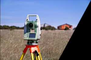
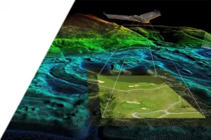
Our topographical surveying services utilize advanced GPS and UAS technology to create detailed 3D terrain models and aerial imagery. This service supports engineering, construction, and land development projects by providing accurate elevation data and surface features. Clients benefit from faster project timelines and enhanced decision-making through precise spatial analysis.
Machine Control Surveys
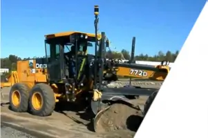
Machine control surveys integrate 3D modeling files with GPS-equipped earth-moving equipment for precise grading and excavation. This technology optimizes construction efficiency by reducing manual measurements and minimizing material waste. Contractors achieve accurate site preparation for drainage, foundations, and infrastructure projects through real-time positioning guidance.
ALTA/ACSM Surveys
ALTA/ACSM surveys meet strict standards for commercial property transactions, ensuring compliance with mortgage lending requirements. These detailed boundary surveys identify easements, encroachments, and legal property descriptions. Our expertise in regional topography ensures accurate documentation for title insurance and land development.
FEMA Flood Certificates
FEMA flood elevation certificates determine a property's flood risk for insurance and compliance purposes. Our surveys measure building elevations relative to flood zones, supporting accurate floodplain management and mitigation planning. Clients receive certified documentation required for flood insurance rate determination.
Hydrographic Surveys
In-shore hydrographic surveys map underwater terrain for coastal engineering and environmental studies. Using specialized sonar equipment, we collect depth data and submerged feature information for navigational safety and dredging projects. This service supports infrastructure development in tidal and riverine environments.
Questions
What surveying services do you offer?
We provide topographic surveys, ALTA/ACSM surveys, FEMA flood certificates, machine control surveys, hydrographic surveys, and construction stakeout services for residential, commercial, and infrastructure projects.
Do you serve areas outside Virginia?
Yes, we serve all of Southeast Virginia and extend our services to Northeast North Carolina counties for comprehensive surveying solutions.
What technology do you use for surveys?
We utilize cutting-edge GPS systems, unmanned aerial vehicles (UAS), and machine control technology to ensure precise data collection and efficient project execution.
How do I request a surveying quote?
Contact us via phone at 757-963-5261 or use our online contact form to request a free consultation and project estimate.
Are your surveys compliant with mortgage requirements?
Yes, our ALTA/ACSM land title surveys and flood elevation certificates meet all mortgage lending standards for property transactions and insurance purposes.
What are your business hours?
Our office is open Monday through Friday from 8:00 AM to 5:00 PM. Emergency after-hours requests can be submitted through our online contact form.
Reviews (2)
Brian Paul
Mar 29, 2022
Report
Very please with their services. Miles was the onsite surveyor and Alan Phillips did the actual drafting of the survey - Both were very responsive - I had a digital copy of the plot within two days and the hard copy arrived by mail within a week
Logan Foster
Jan 18, 2022
Report
We got a survey done for our house and land in Chesapeake and Alphatec was so easy to work with. Communication was on point and they were responsive with questions I had before and after. They showed up on time and did a thorough job. I definitely recommend them for surveyors either before you buy a house or for your existing house!