
Business Details
Emergency
services
Geospatial Data & Surveying Services for Infrastructure Projects
At SAM, we specialize in delivering precise geospatial data and surveying solutions to empower informed decision-making for infrastructure projects. With advanced technologies and a team of experienced professionals, we provide foundational insights that drive program success across utilities, transportation, and government sectors. Our national reach, combined with local expertise, allows rapid deployment within 24 hours, ensuring timely, accurate data collection from land surveys to digital modeling. Recognized as a Top Workplace and industry innovator, we prioritize collaboration, technological advancement, and client-centric service to transform complex challenges into actionable strategies. 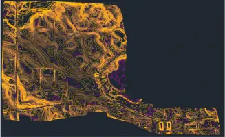

Services
Land Surveying
Aerial Mapping
GIS Consulting
BIM/3D Laser Scanning
Subsurface Utility Engineering
Highlights and features
- We deploy teams within 24 hours for urgent geospatial data needs.
- Our experts utilize advanced technologies like LiDAR and BIM for precision.
- Nationwide coverage with local teams ensures project-specific expertise.
- Recognized as a 2025 Top Workplace for our collaborative culture.
- 13 consecutive years on ENR's Top 500 Design Firms list.
Services
Land Surveying
Our land surveying services deliver precise boundary and elevation data for infrastructure projects. Using advanced GPS and robotic equipment, we ensure accuracy in site assessments, construction layout, and legal documentation. Clients benefit from faster permitting and reduced project risks through our meticulous field data collection and analysis.
Aerial Mapping
Aerial mapping combines high-resolution drones with LiDAR to create detailed 3D terrain models. This service accelerates large-scale project planning by capturing vast areas in less time than traditional methods. Clients gain actionable insights for transportation corridors, utility corridors, and environmental monitoring through our FAA-certified drone operators.
GIS Consulting
GIS consulting transforms raw geospatial data into strategic decision-making tools for utilities and municipalities. We integrate diverse data sources to create interactive maps for asset management, route optimization, and disaster response planning. Clients improve operational efficiency through our custom GIS solutions tailored to specific infrastructure challenges.
BIM/3D Laser Scanning
BIM and 3D laser scanning create accurate digital replicas of physical assets for construction and maintenance. This service captures millimeter-level detail to support clash detection, as-built documentation, and facility management. Clients reduce rework and enhance collaboration through our immersive 3D modeling solutions for complex infrastructure projects.
Subsurface Utility Engineering
Subsurface utility engineering identifies underground utilities using ground-penetrating radar and electromagnetic detection. This service prevents costly strikes during excavation while ensuring compliance with safety standards. Clients gain comprehensive utility maps for project planning through our SUE Level A to D assessments.
People
Greg Cleveland
PE, CCM
Greg specializes in construction management and augmented reality applications, leading innovative visualization solutions for infrastructure projects.
Adam Long
PE, PS, RPLS
Adam combines professional engineering and surveying expertise to enhance project planning with advanced spatial technologies.
Michael Covarrubias
CIM Standards Expert
Michael drives utility data transformation through CIM standards implementation, improving connectivity and grid modernization strategies.
Dr. Jerry Gray
Transmission Network Specialist
Dr. Gray optimizes powerline data management systems to improve operational efficiency for utility clients nationwide.
Matthew Reinhart
PE, Transportation Director
Matthew leads transportation infrastructure projects with over 15 years of experience in highway and rail engineering solutions.
Questions
What industries does SAM serve?
We support utilities, transportation, government, and natural resource sectors with geospatial solutions.
Can SAM handle emergency projects?
Yes, our teams deploy within 24 hours for urgent data collection needs.
What technologies does SAM use?
We utilize LiDAR, BIM, GIS, and aerial mapping technologies for precision projects.
Are SAM's services nationwide?
Yes, we offer national coverage with local teams for project-specific expertise.
What sets SAM apart from competitors?
Our rapid deployment, advanced technology integration, and 13-year industry recognition distinguish us.